When we count points of two data sets per cell, we can compare their densities. Generating Chi expectation surfaces allows us to compare actual with expected densities. To come back to our geographical names with “wald” in Switzerland, we could compare if these names are over- or underrepresented compared to all the geographical names.
Tag Archives: Ortsnamen
Working with point data (II)
This is part II of the point data tutorial for QGIS. It teaches you how to create a grid to calculate a density surface, that is to count the points per grid cell.
Selecting point data in QGIS (I)
Let’s assume: You have imported point data into QGIS and want to analyse it further. This short tutorial shows you step by step how you can filter your dataset based on an attribute or on the spatial location.
Was uns Ortsnamen verraten
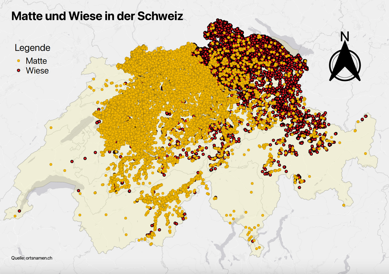
Wie sind Ortsnamen mit «Wiese» und mit «Matte» über die Schweiz verteilt? Wie lässt sich diese räumliche Verteilung erklären? Im Mastermodul «Einführung in die Onomastik» haben sich Germanistikstudierende unter anderem mit solchen Fragen befasst. Die Kartierung hat ihnen geholfen, Muster zu entdecken und Antworten zu finden.


