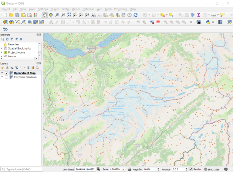
Hier findest du zuoberst Tutorials zu QGIS (die deutsche Version ist als PDF in den Posts verlinkt). Mehr Informationen zu Daten und Infrastruktur findest du, wenn du runterscrollst.
Tutorials
How to create a map layout?
You need a map for a paper or a presentation? This QGIS tutorial shows you how to create a layout for your map with a title, a legend, a north arrow, a scale etc., which you can export as image or PDF.
Comparing two sets of point data (III)
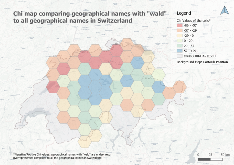
When we count points of two data sets per cell, we can compare their densities. Generating Chi expectation surfaces allows us to compare actual with expected densities. To come back to our geographical names with “wald” in Switzerland, we could compare if these names are over- or underrepresented compared to all the geographical names.
Working with point data (II)
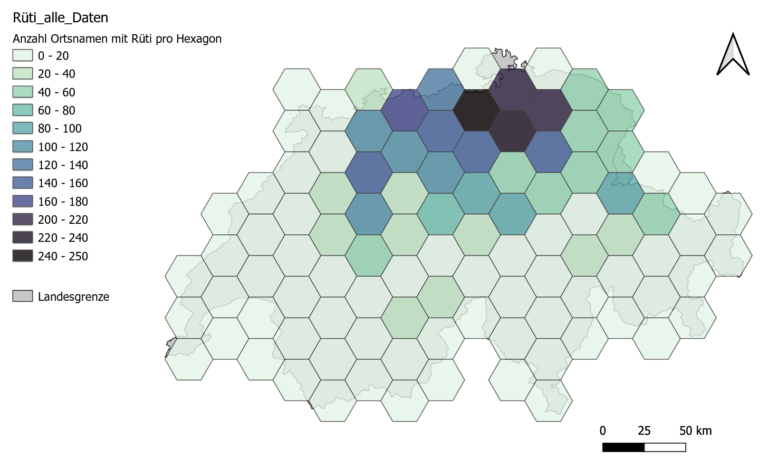
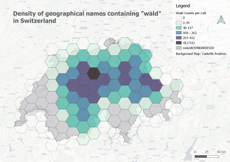
This is part II of the point data tutorial for QGIS. It teaches you how to create a grid to calculate a density surface, that is to count the points per grid cell.
Selecting point data in QGIS (I)
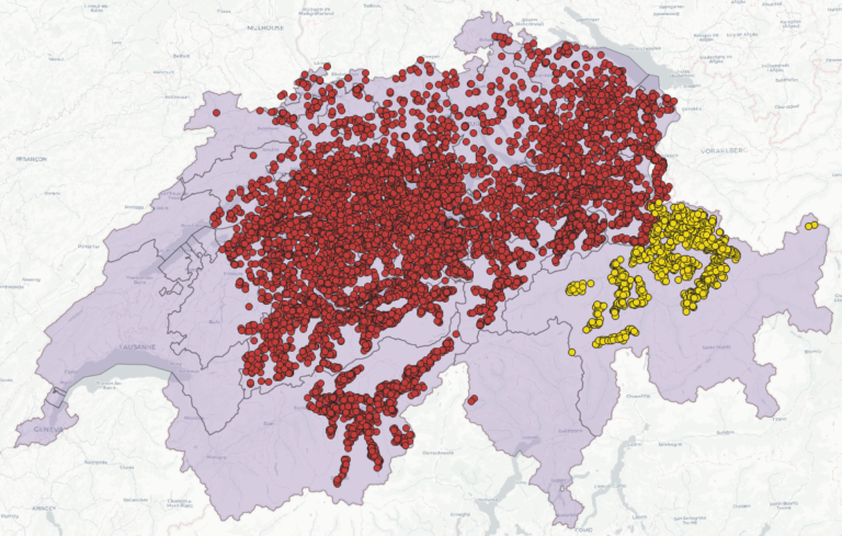
Let’s assume: You have imported point data into QGIS and want to analyse it further. This short tutorial shows you step by step how you can filter your dataset based on an attribute or on the spatial location.
How to start a new project in QGIS?
You have spatial data and know what you want to analyse, but how do you start? This short tutorial gets you started and guides you step by step through a project setup.
Minor Spatial Data Science
Die UZH führt im Herbstsemester 2025 einen neuen Minor in Spatial Data Science (30 ECTS) ein. Mehr Infos findest du hier.
Infrastruktur
– UZH QGIS Cloud
– Zugang zu ArcGIS Online und ArcGIS Pro mit deinem UZH-Konto (klicke auf den Link und fülle das Formular aus. Du wirst benachrichtigt, sobald dein Konto aufgesetzt worden ist. Falls du am GIUZ arbeitest oder studierst, kannst du dich auf uzh.maps.arcgis.com direkt mit deinem UZH Shortname und Passwort anmelden.)
Daten
Topographische Raster- and Vektorkarten, Digitale Höhenmodelle und Orthofotos (GeoVITe, offen für alle Studierenden und Forschenden der UZH, via Switch edu-ID)
Open Data Schweiz
Eine kleine Auswahl an frei verfügbaren Daten für die Schweiz:
– Open Data Zürich (von der Stadt Zürich)
– Swiss Open Government Data (by the Swiss Federal Statistical Office, FSO)
– Open Data Collection, kuratiert von S. Graf
Ein paar globale Open Data Quellen
– Overpass turbo, a web-based data filtering tool for OpenStreetMap
– World Bank
– UNESCO
– SprachGIS (in German, “Language GIS”) on regionalsprache.de
– OGD Portal Deutschland
– OGD Portal Österreich
– OGD Portal EU
– OGD Portal UK
– OGD Portal USA
Karten
– Kartenportal.CH: Fachportal für Karten der Schweizer Bibliotheken und Archive
External Tutorials and other support material for QGIS
- QGIS Anfänger*innen Tutorials in unserem Blog (deutsche PDFs sind jeweils ganz unten im Post zu finden): How to start a new project in QGIS? , Selecting point data in QGIS, Working with point data (II) etc.
– QGIS Spick (von openschoolmaps.ch)
– QGIS Training Material (by qgis.org, in various languages)
– QGIS Basics Wiki (von Daniel Ursprung)
– QGIS Kurse von Coursera
– Tutorials für die QGIS Cloud (von Leyla Ciragan)
External Tutorials and other support material for ArcGIS Online
– ArcGIS R Bridge Tutorial (by Stefan Graf from ESRI Switzerland)
– ArcGIS Online for Beginners | Learning Plan (esri.com)
– Essential ArcGIS Online skills | 10 Tutorials (esri.com)
